Africa is home to tremendous resources that hold the promise of supporting thriving communities and economies, including sustainably feeding a billion or more people. At the same time, its rising population and increasing climate variability pose dual challenges for achieving its full potential. Compounding these trends is the reality that essential information about water flows, food security, disaster risks, and other environmental data needed for decision – and policy-making has historically been limited and often unreliable.
Africa is home to tremendous resources that hold the promise of supporting thriving communities and economies, including sustainably feeding a billion or more people. At the same time, its rising population and increasing climate variability pose dual challenges for achieving its full potential. Compounding these trends is the reality that less than five percent of Africa is currently mapped to a sufficient resolution for essential information about water flows, food security, disaster risks, and other environmental data needed for decision- and policy-making.
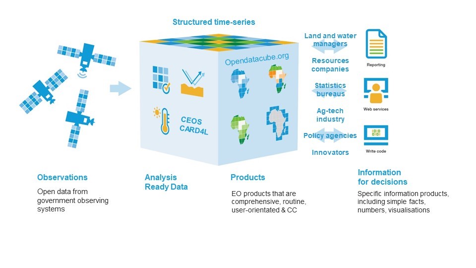
Free and open Earth observations of Africa offer a critical tool for enhancing planning and resilience measures and shifting course away from impending environmental and climate challenges. Digital Earth Africa (DEA) is building the world’s largest free platform that encompasses four decades’ worth of satellite data and, as a result, captures Africa’s changing ecosystem. DEA’s potential for driving massive, positive changes across the continent by making data relevant and useful for millions of people attracted the interest — and, eventually, funding — of the Helmsley Charitable Trust.
This model began in 2017, when the Australian government led the creation of Digital Earth Australia, which is already proving to be valuable in unexpected ways. Building on this success, Digital Earth Africa will enable governments, researchers, and ordinary citizens to track changes across the continent in unprecedented detail through open-source, free, analysis-ready satellite data. This will enable insights for better decision-making in sustainability and land use, climate resilience, water quality and availability, agricultural planning, food security, and more. For instance, because land use practices will be visible to all, people can monitor crop growth, which helps marketplaces prepare for harvests, and identify illegal mining as it happens — ultimately providing the timely knowledge that will lead societies to take action.
Satellite images will be high-resolution, allowing for real-time observations of change, as well as longer-term trends and shifts. This will help arm the public — from government officials, to NGOs, to business leaders and farmers — with the information required to make data-rich cases for efforts to improve health outcomes and support economic growth and overall sustainability. Digital Earth Africa also offers new ways to measure progress (or lack thereof) toward achieving the Sustainable Development Goals, especially using Open Data Cube technology.
While Helmsley’s Vulnerable Children in Sub-Saharan Africa Program focuses on the particularly underserved areas of Burkina Faso, Ethiopia, Ghana, and Zambia, the funding will allow Digital Earth Africa to survey the entire continent for the first time, impacting millions of lives. Further, the Data Cube model is one that other developing countries and continents can adopt moving forward.
Watch this video to learn more about Digital Earth Africa.
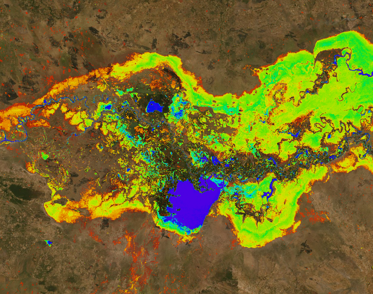
*This background image from Digital Earth Africa’s Map is a visualization of the Kafue River in Zambia, colored to represent where water has existed from 2013-2019. Red represents the rare presence of water, green represents an occasional presence of water, and blue represents where water has always existed.